Map of Kingswood 1610

Page Details
Section: Articles =>
Subjects: Radical Bristol
Tags:
Posted: Modified:

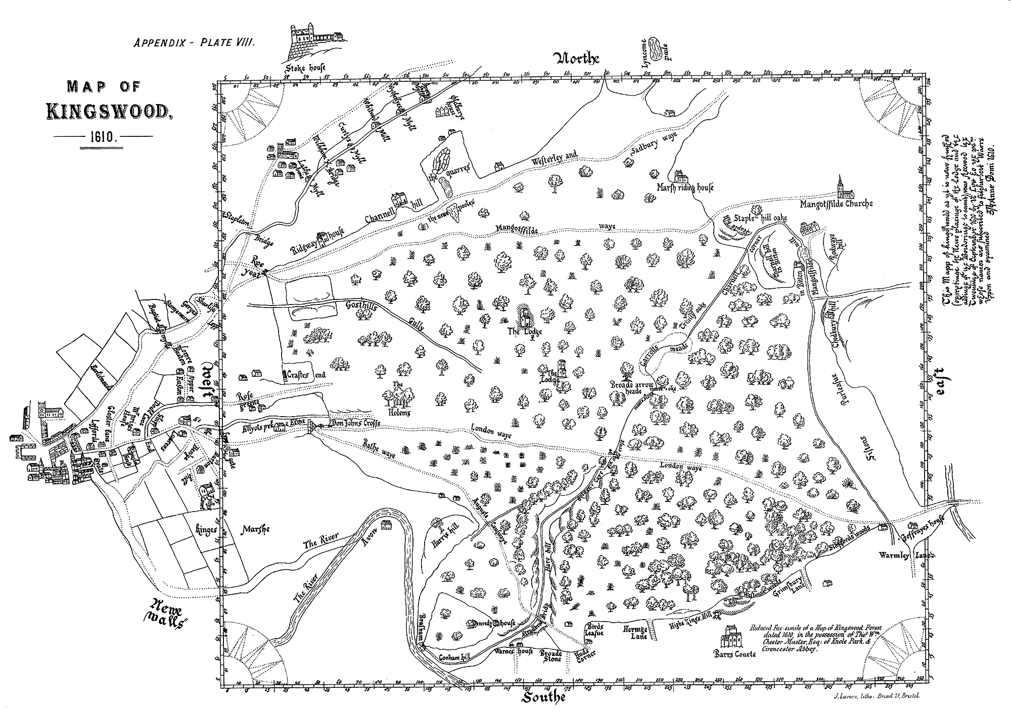
Home to the notorious Kingswood Miners and infamous Cock Road Gang this is what Kingswood, North of Bristol, looked like in 1610. ‘London Waye’ is now the A420 and Bath Waye is the A431.

Map of Kingswood 1610, Gloucestershire. PlateVIIII from The History of the Parish of Bitton, in the County of Gloucester by Rev. H. T. Ellacombe (William Pollard, Bristol: 1881)‡. Found in Bristol Central Reference Library.

A full version of The History of The Parish of Bitton in the County of Glousceter. by Rev. H. T. Ellacombe can be found on Archive.org.

1 Comment

  1. Very interesting, my Ancestors were Miners in and around Bitton and Siston, I’d be very interested to know more about Mining in the area.

Leave a Reply

Your email address will not be published. Required fields are marked *

You may use these HTML tags and attributes: <a href="" title=""> <abbr title=""> <acronym title=""> <b> <blockquote cite=""> <cite> <code> <del datetime=""> <em> <i> <q cite=""> <s> <strike> <strong>

This site uses Akismet to reduce spam. Learn how your comment data is processed.

Pin It on Pinterest

Share This